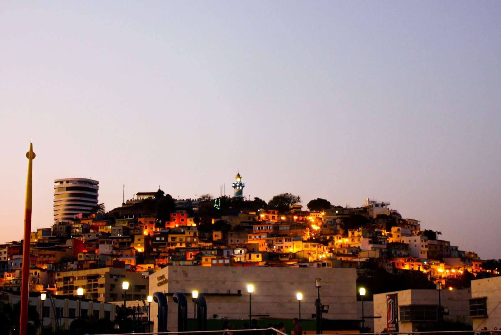
Cerro Santa Ana, an emblematic place in Guayaquil. Coloured by its houses, cafes, bars and souvenir shops.
Words & Photos: Trail Forth Journal.
This place is the cradle where Guayaquil was born in the XVI century, in the decades between 1540 and 1550. Formerly called “Cerrito Verde” or “Cerrito de la Culata”, it is considered the place where the city of Guayaquil was born. When the Spaniard Diego de Urbina settled the city on the slopes of the hill. Because of the shape of the junction of Cerro del Carmen and Santa Ana, which formed a saddle-shaped image. The city was also called “Ciudad de la Gineta Ensillada” (City of the Saddle Genet). It is believed that the name of Santa Ana comes from an old legend, according to which the Spanish soldier Nino de Lecumberry, in danger of death during one of his missions, invoked this saint to save him. When he succeeded, he placed a cross with the inscription “Santa Ana” on the top of the hill in gratitude. From then on, the settlers began to call the place “Loninchao”.
Cerro Santa Ana, seen from the Malecon 2000.
Studies show that there is a chapel where the lighthouse is today. Around 1600, in front of the church where the lighthouse stands today, there were the Casas del Cabildo. These houses were made of wood and had tiled roofs. They were burnt down in 1624 during the invasion of the Heremite pirates. Ten years later, the main church was used as the provisional seat of the City Council.
Cerro Santa Ana, today.
Vista del Museo El Fortín.
Today this place can be visited thanks to projects managed and financed by the Muy Ilustre Municipalidad de Guayaquil. There are two ways to get there. One is to climb the stairs, and the other is to walk along Numa Pompillo Llona Street, which ends at Puerto Santa Ana. Both routes are connected by a pedestrian street called El Galeón, with the Diego Noboa steps. Along the route of El Galeón there are planters, multi-purpose areas, ornamental posts, children’s playgrounds and viewpoints.
Many of the railings that exist in the square have been reused from the old Simon Bolivar promenade. Nowadays, this place has houses of mixed construction, leisure centres and spaces dedicated to history and culture. The Diego Noboa y Arteta Staircase is 310 metres long. The Cerro Santa Ana currently has ramps and access for people with reduced mobility, as well as urban furniture along the entire staircase, spaces for monuments and ornamental figures.
Cerro Santa Ana activities.
According to the data collected, the hill has an estimated 20,000 visitors per week, cultural events are held there and there are several museums, among which: the Julio Jaramillo Lurido Popular Music Museum, the Astillero Teams – local and national celebrities: Barcelona and Emelec, and the Beer Museum.
Cerro Santa Ana location map.
Choose one of the activities you can do near Cerro Santa Ana.
Walk around Cerro Santa Ana.
Stairs, museum, chapel and lighthouse.
Here you will find the El Fortín Museum, an open-air museum that tries to recreate the maritime history of Guayaquil. Here you can see replicas of the bow and stern of the ship “La Capitana” (inside there is a coffee bar), a ship full of treasures that was shipwrecked off the coast of Chanduy, as well as cannons with which the city defended itself against pirate attacks and various instruments used between the 16th and 18th centuries.
Some of the instruments found in the square are originals, while others are replicas. Continuing along the Diego Noboa Steps, you will come to the Mirador Plaza ‘El Fortín’, made up of the lighthouse, a chapel and the Plaza de Honores. This place has the function of being a viewpoint for those who visit this part of the city. The chapel reproduces the colonial architecture of the Cerro Santa. Its 14 stained glass windows depict the Passion of Jesus Christ. It also has some religious images and a bronze bell tower, as well as a baptismal font with engravings that were used to decorate it in the past.
The lighthouse at the top of Cerro Santa is a replica of Ecuador’s first lighthouse, built in 1841 on the island of Santa Clara in front of Punta de Piedra in the Gulf of Guayaquil. Like the chapel, it reproduces colonial features and its design was based on an engraving by the historian José Antonio Gómez. The lighthouse is 20 metres high. From the top of Cerro Santa Ana you have the best view of the whole city of Guayaquil, Durán, Santa Island, the Guayas River and Samborondón.
Cerro Santa Ana and the Port of Santa Ana are urban regeneration projects that have transformed the lives of the city’s inhabitants. Especially because of the infrastructure works that have been carried out, not only with the aim of beautifying the city, but also as a social development project that has managed to integrate the community into the tourist activity. Cerro Santa Ana covers an area of approximately 13.5 hectares.


